Low-pressure that had formed over the south-eastern Bay of Bengal has intensified into a deep depression. According to the Bangladesh Meteorological Department (BMD), it is expected to develop into a cyclonic storm.
The information was announced in a special weather bulletin issued at 10 am today, Sunday. The bulletin also included details regarding the cyclone’s distance from Bangladesh’s seaports.
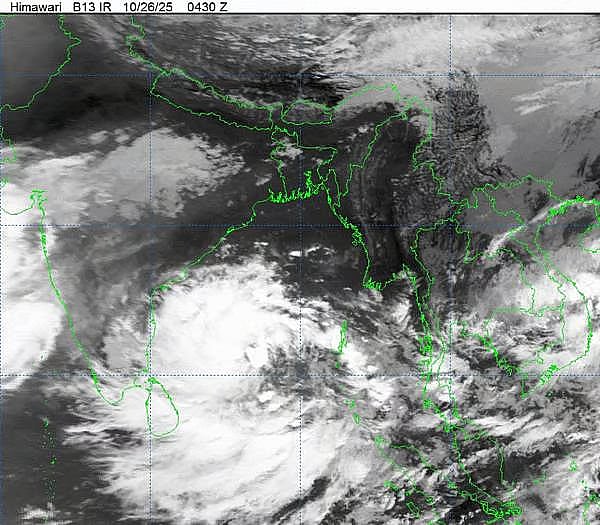
According to the BMD, at 6 am today, Sunday, the deep depression was positioned approximately 1,340 kilometres south of Chittagong seaport, 1,270 kilometres south of Cox’s Bazar seaport, 1,300 kilometres south of Mongla seaport and 1,265 kilometres south of Payra seaport. The system is likely to move further northwest and intensify into a cyclonic storm.
The meteorological office has advised the ports of Chittagong, Cox’s Bazar, Mongla and Payra to hoist distant cautionary signal number one.
All fishing boats and trawlers operating in the North Bay and deep sea have been instructed to remain close to the coast until further notice.
Where the cyclone may hit
Meteorologist Md Bazlur Rashid of the Bangladesh Meteorological Department told Prothom Alo that it is certain the deep depression will develop into a cyclone.
However, its probable landfall area is expected to be along the coast of India’s Odisha or Andhra Pradesh states.
“It may transform into a cyclone by tomorrow, Monday and by the following day, Tuesday, it could intensify into a severe cyclonic storm and strike the coastal regions of Odisha and Tamil Nadu,” he added.
When asked how much of an impact the cyclone might have on Bangladesh, Bazlur Rashid explained that it would depend on the storm’s strength after making landfall.
“Once it moves to the land, it may weaken and travel across Bihar and West Bengal before reaching Bangladesh. As a result, different parts of Bangladesh may experience rainfall from Wednesday onwards,” he said.
He further mentioned that rainfall is expected in the northern regions, including Rajshahi and Rangpur divisions, as well as parts of the southern Khulna division, lasting until the end of the month.
The capital, Dhaka and its surrounding areas may also experience rain.
According to the Indian Meteorological Department’s bulletin, the cyclone is likely to make landfall as a severe cyclonic storm between Machilipatnam and Kalingapatnam along the Andhra Pradesh coast, near Kakinada and surrounding areas.
During landfall, the maximum sustained wind speed may range between 90 and 100 kilometres per hour, with gusts reaching up to 110 kilometres per hour.