An international team of earthquake researchers has discovered another active underground fault line in Bangladesh. It stretches from Jamalpur and Mymensingh in Bangladesh to Kolkata in India — a length of about 400 kilometres.
A portion of this fault line is earthquake-prone, and that portion lies within Bangladesh. The research indicates that it is capable of generating earthquakes of up to magnitude 6.
Earthquake experts have long identified two major fault lines in the country: the Dawki Fault and the Indo-Burma Megathrust (a megathrust is a major earthquake-generating fault caused when large tectonic plates press beneath one another). Besides these, there are known coastal faults in Sitakunda and fault lines in Madhupur, Shahjibazar, Jaflong, and Cumilla. The newly identified fault line adds to this list.
The new fault line has been identified through research led by Aktarul Ahsan, Deputy Director of the Geological Surveyof Bangladesh. Researchers from the United States, France, Turkey and Bangladesh were also involved.
Aktarul Ahsan is pursuing a PhD in earthquake studies at Auburn University in the United States. One of his co-advisors is geophysicist Michael S. Steckler, a professor at Columbia University’s Lamont-Doherty Earth Observatory.
Ahsan told Prothom Alo that from 14 to 19 December, the American Geophysical Union will hold a six-day international conference of American geologists in Louisiana, USA. The detailed findings of this research will be presented there.
Ahsan said he and his team began the research in March 2024 using the “tectonic geomorphology” method. The research has recently been completed, and the fault was identified through this study. He said the fault has been divided into three segments. One segment carries a low earthquake risk, a second segment carries a higher risk, and a third segment carries no earthquake risk.
Ahsan said he does not want to disclose at this stage which segment has higher or lower risk. He said a research article will soon be published in a world-renowned journal, where the details will be provided.
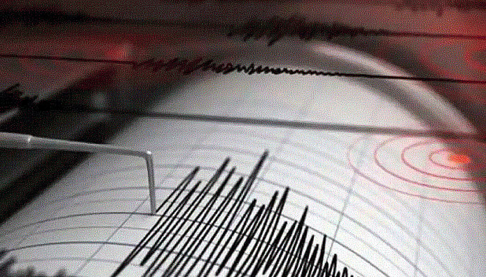
Bangladesh experienced four earthquakes across two days on 21 and 22 November. One of them — the 21 November quake — measured 5.7 on the Richter scale. Ten people died in this earthquake. In previous years, several earthquakes occurred, but none caused such fatalities. The repeated tremors have created public anxiety.
Citing British geologist Charles Stewart Middlemiss, Humayun Akhter wrote that the tremors from this earthquake were felt in parts of India, Bhutan and Myanmar. At least 75 deaths were confirmed, including 40 in Sherpur. Mymensingh suffered extensive damage.
Another Fault Line in the New Study
The new study states that the newly identified fault line originated 56 million years ago — a period known in geological terms as the Eocene epoch. The fault, once active, remained inactive for 23 million years, known as the Miocene epoch. About 5.6 million years ago, the Indian Plate (the tectonic plate underlying the Indian subcontinent and surrounding regions) and the Eurasian Plate (the plate underlying Asia and Europe) pushed against each other, causing the Meghalaya uplands to rise from beneath the earth. This reactivated the fault line.
Tectonic geomorphology refers to internal and external changes in landforms and the earth’s surface caused by pressure or impacts from within the planet. According to the new study, the Indian Plate is currently subducting beneath the Eurasian Plate at 46 millimetres — or 4.6 centimetres — per year.
This rate has varied over time — sometimes directly northward, sometimes shifting toward the northeast. At times the speed increased; at times it slowed. The Dawki Fault and the newly discovered fault both originated due to the movement of the Indian Plate.
Ahsan said the movement of the Indian Plate has also created many other faults in the Bengal Basin. Some of these faults are capable of generating earthquakes; others are not. The new study found evidence linking the newly discovered fault to several large historic earthquakes and to changes in the course of the Brahmaputra River. The shifting of the Brahmaputra’s course continues to this day.
One major earthquake directly linked to the new fault is the “Bengal Earthquake” of 1885. Former Dhaka University professor Humayun Akhter noted in a 2010 research paper that it was a magnitude 7 earthquake. Its epicentre was in Manikganj. It is believed to have occurred along the Madhupur Fault Line.
Citing British geologist Charles Stewart Middlemiss, Humayun Akhter wrote that the tremors from this earthquake were felt in parts of India, Bhutan and Myanmar. At least 75 deaths were confirmed, including 40 in Sherpur. Mymensingh suffered extensive damage.
Another earthquake occurred in 1923 in the Mymensingh-Kishoreganj region, which is listed as magnitude 6.9 in the USGS Earthquake Catalogue. Ahsan’s study indicates this earthquake is also connected to the newly identified fault line.
The study’s satellite-based “morphological change” mapping was assisted by Dhaka University geology associate professor Ashraful Islam. He told Prothom Alo, “Our geological reality is that many fault lines exist here. More such faults will be identified if further research is conducted.”
He added that the presence of fault lines does not necessarily mean high-magnitude earthquakes will occur.
In 1918, a magnitude-7.6 earthquake struck Sylhet’s Srimangal and surrounding areas, killing nine people in Bangladesh and Assam. In 1923, an earthquake of magnitude 7.1 struck Meghalaya, causing 50 deaths in Mymensingh.
33 Major Earthquakes in the Region
In a 2010 study, earthquake expert Humayun Akhtar listed 33 strong earthquakes that struck Myanmar, Assam, Shillong, and Bangladesh between 1548 and 2009. Among them, the 12 June 1897 earthquake, with a magnitude of 8.7, devastated 390,000 square kilometres. The study also records building collapses in Mymensingh due to earthquakes of magnitude 6.2 in 1846, 7.3 in Pabna in 1842, and damage in Mymensingh from a magnitude 7.1 quake in 1822.
On 10 April and 11 May 1812, two earthquakes caused damage in Dhaka. Though the magnitudes were not recorded, the study notes that several buildings in Tejgaon collapsed.
In 1918, a magnitude-7.6 earthquake struck Sylhet’s Srimangal and surrounding areas, killing nine people in Bangladesh and Assam. In 1923, an earthquake of magnitude 7.1 struck Meghalaya, causing 50 deaths in Mymensingh.
Commenting on the new fault line, former Director General of the Geological Survey and earthquake geologist AKM Khorshed Alam told Prothom Alo: “I know the research Ahsan is doing. The use of the modern technique of tectonic morphology to detect this fault is a reliable method.” He added, “After an earthquake, we infer that a fault exists. But determining its extent, how much energy is accumulated within it, and how often major earthquakes might recur — these are what researchers aim to uncover. Hopefully, the study will reveal these details.”